
By: Gordon Rutherford
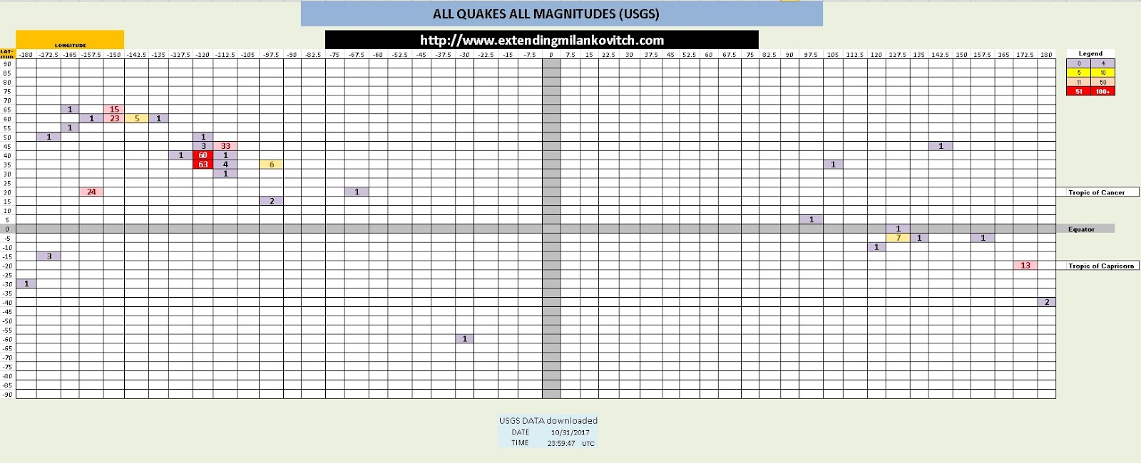
USGS DATA downloaded
DATE 10/31/2017
TIME 23:59:47
Number of quakes >2.5m 61
Number of ALL QUAKES 278
Highest Magnitude Quake
Depth = 11.06 km
Magnitude = 6.8
UTC Time = 00:42:06
137km E of Tadine, New Caledonia
Deepest Quake
Depth = 340.14
Magnitude = 4.2
UTC Time = 17:35:19
126km SSW of Raoul Island, New Zealand

Magnitudes #
2.5m 21
3m 3
4m 14
5m 21
6m 2
7m 0
8m 0
9 + 0
Depth KM #
Surface 0-5km 12
43 6-15km 26
16-25km 5
Deep 26 - 50km 9
18 51 - 99km 4
100 - 199km 4
200 - 299km 0
300 - 499km 1
500 + 0
Epicenter Magnetic Polarity
Totals Percentage
RED 48 78.69%
GREEN 9 14.75%
BLUE 4 6.56%

NASA JPL Data
- Lunar and Combinational Geometries

Adding the Rotating Solar Magnetic Field


USGS Local Times Summarized
- NASA JPL and Tidal Data

Local Times Summarized
- To NASA JPL Data

Earthquake Magnetic Polarity Distribution
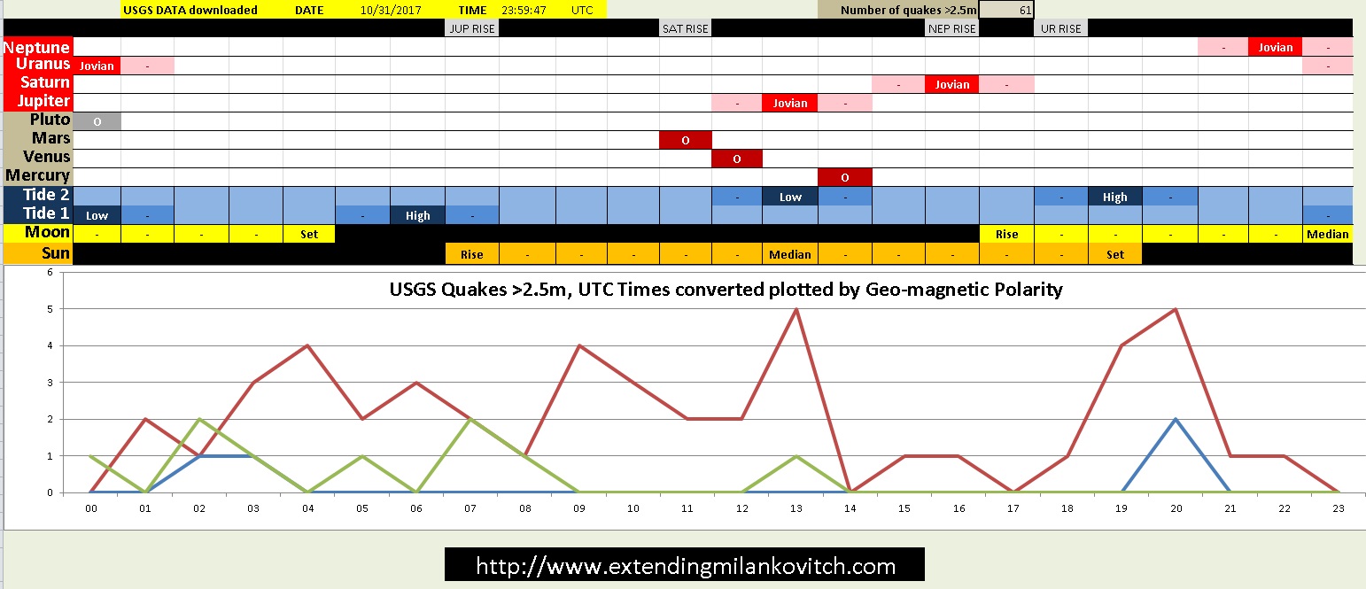
USGS Data and Conversions

Hi Gordon, Trying to follow your logical thread and what the epicenter magnetic polarity comes from. Do you have some discussion document of these images to follow along on your arguments? I feel your on to some interesting relationships worth discussing.
ReplyDelete